Published as part of our Indigenous Perspectives series featuring Indigenous-led initiatives to address and respond to climate change.
Introduction
The Gitanyow people of the Middle Nass and Upper Skeena watersheds, located on unceded territory in northwestern British Columbia, are governing ourselves and exercising jurisdiction over the Lax’yip (territory) through the Ayookxw (Gitanyow laws). The ability of the Gitanyow to carry out these responsibilities is impeded by ongoing colonialism and the decisions of the settler state, primarily the Province of British Columbia, to permit activities in Gitanyow Lax’yip without the consent of the Gitanyow. The cumulative impacts of forestry, highways, mining, proposed pipelines and the Northwest transmission line have spurred Gitanyow to develop contemporary expressions of our Ayookxw to counter the colonial administrative apparatus. A comprehensive land use plan and other legal and policy instruments have been developed to establish Gitanyow standards for the behaviour of industrial proponents in the Lax’yip.
A key part of this sustainability approach is acknowledging the broader impacts of climate change on Gitanyow territory. Gitanyow understand that water flow from glaciers is an important part of the ecology of some watersheds, which will change over time as glaciers recede. What has historically been good fish habitat may no longer serve the same fish populations, and other streams may become more suitable fish habitat. While the land use plan has been a foundational policy instrument in addressing cumulative effects, its signing in 2012 predates the more significant impacts of climate change in the Lax’yip that are now more common.
To address these changing conditions, Gitanyow established a Sustainability Director position and have embedded climate change assessment criteria and adaptability into policies and practices. Examples of this attention to climate change include evaluating environmental flows and water quality throughout the Lax’yip, glacier surveys, and developing a water quality and quantity policy. The overall objective of this work is to set standards for activities and cumulative impacts in the Lax’yip and require proponents to demonstrate that their proposed project or activity will not exceed those standards.
Glossary of Gitanyow terms
Lax’yip: The ancestral territories of the Gitanyow.
Wilp: House group—the primary political, social, and decision-making unit of the Gitanyow, each with its own well-defined territories managed according to a strong and enduring system of land management.
Huwilp: The collective of eight Wilp that collectively constitute the Gitanyow People.
Ayookxw: Gitanyow laws that ensure peace and order for the Huwilp.
Adawaak: The oral history of each Wilp.
Ayuuks: Crests that codify the oral history of each Wilp.
Li’ligit: A formal public gathering and feast initiated by a Wilp to conduct its business.
For more information, see “Legal Principles Underlying the Gitanyow Lax’yip Land Use Plan.”
Gitanyow Nation: Governance and Territory
The Gitanyow people are collectively known as the Gitanyow Huwilp. The Lax’yip (territory) is located primarily in the Middle Nass and Upper Skeena watersheds and covers a total area of 6296 square kilometres. The Gitanyow Huwilp refers to the collective of eight Wilp (house groups), organized into two Pdeek (clans), the Lax Gibuu (Wolf) and the Lax Ganeda (Frog/Raven). The Lax’yip of each Wilp is embedded in the Git’mgan (totem pole) and is rooted in Adawaak (oral history of each Wilp), Ayuuks (crests), and Ayookxw (Gitanyow law). Each Wilp has jurisdiction and exclusive rights to Wilp names, Adawaak, Ayuuks, Git’mgan and Lax’yip.
The Gitanyow Huwilp are an autonomous, social, economic and political unit of the larger cultural group the Gitksan peoples. Each Wilp has well defined territories managed according to a strong and enduring system of land ownership and management. Individual Wilp exercise jurisdiction over their territory and Wilp members on issues such as access to land and water, succession in the use of land and water, protection of land and the environment for future generations, and reaffirmation of authority and responsibility over the territory. The Gitanyow histories, laws, territories and institutions have always existed and will continue to exist forever, and are recognized by the Province of British Columbia and Government of Canada pursuant to section 35 of the Constitution Act, 1982. In addition, the Gitanyow people have entered into a number of government-to-government agreements with British Columbia where the Province has recognized the Gitanyow people’s authority and jurisdiction to make decisions based on our own laws, policies, responsibilities and protocols.
The Ayookxw are Gitanyow laws that ensure peace and order for the Huwilp. Ayookxw set out ownership of the land, use of and care for the environment, conduct of a Li’ligit (feast), relationship with one another, and inheritance. Ayookxw are founded on knowledge, experiences and practices that are thousands of years old and are recounted in the Adawaak and Ayuuks. Ayookxw is reaffirmed and confirmed through testimony on the Adawaak and the Li’ligit. A Wilp and the Huwilp may adopt new Ayookxw in order to meet new and evolving challenges of the contemporary world. Recognition for Ayookxw is part of the framework of section 35, Constitution Act, 1982, put forward by the people and governments of Canada. The Gitanyow have documented our oral Ayookxw into The Gitanyow Constitution, 2009, to help the provincial and federal governments better understand the Indigenous laws of the Gitanyow.
A key feature of the Gitanyow Lax’yip and culture is the annual return of several species of salmon throughout the watersheds. The many small catchments that contribute to the ecology and flow of eight major watersheds—the Bell-Irving, Cranberry, Kinskuch, Kispiox, Meziadin, Nass, Skeena and White Rivers watersheds—ultimately connect to either the Skeena River or the Nass River. Watersheds in the Gitanyow Lax’yip typically follow a seasonal pattern where snow and ice mean low flows in the winter, the spring freshet results in maximum annual flows, summer flows are variable but warm in July and August depending on the amount of rain, and autumn flows uneven. Groundwater is a variable and largely unknown factor as it interacts with surface water bodies, but it can provide cooling in summer months.
In addition to salmon, other important species to the Gitanyow include trout, moose, cedar, grizzly bear, mountain goat, furbearers such as marten and beaver, pine mushrooms, and berries and medicinal plants such as devil’s club, hellebore and Labrador tea, among others. Gitanyow also trade extensively with coastal First Nations for seafood, seaweed, oolichans, and sea lion.
Contemporary expressions of Gitanyow authority are carried out through the Gitanyow Fisheries Authority and the Gitanyow Hereditary Chiefs’ Office. In addition to managing the salmon fishery through the Gitanyow Fisheries Authority, Gitanyow’s Lax’yip Guardians provide environmental monitoring services for forestry, major projects development, water quality and quantity, hunting permitting, and other wildlife related monitoring throughout the Lax’yip. A combination of fish and wildlife biologists and trained Gitanyow field technicians provide territory-based services for the good of the Gitanyow Huwilp under the direction of the Gitanyow Hereditary Chiefs.

Wilp Sustainability Approach
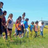
The Gitanyow have a direct and longstanding relationship with the land, water and all of the watersheds within the environment that sustains us. We depend on healthy watersheds to exercise our aboriginal rights to activities such as fishing, hunting, trapping, food and medicinal plant gathering, and spiritual practices. This strong relationship to the land and waters makes protecting and managing land and water critical to Gitanyow culture.
In response to the cumulative impacts on the Lax’yip from non-Gitanyow forestry activities, in 2012 the Gitanyow Hereditary Chiefs enacted the Gitanyow Lax’yip Land Use Plan as a physical expression of Ayookxw that translated legal responsibilities into site-specific directives for anyone – including colonial governments and non-Indigenous natural resource users – permitting or undertaking activities within Gitanyow territory. The Gitanyow Lax’yip Land Use Plan provides management direction for a variety of land use objectives largely oriented to habitat, zones of special designation and protection given threats from forestry activities. Examples of these designations and objectives include Water Management Units, Ecosystem Networks, and the Hanna Tintina Conservancy (a protected area designation in Gitanyow and colonial law that provides for collaborative management and the exercise of aboriginal rights). Objectives and designations also mention monitoring, identifying, and maintaining target or baseline values of water quantity and quality.
The Plan is a fusing of western science and Indigenous Gitanyow knowledge, and was negotiated with the Provincial Government over a ten-year period. Previous to the Plan, forestry consultation was an ad-hoc process and was done primarily at the site-specific level, cut-block by cut-block. There was no overarching landscape level plan to address cumulative effects or to provide greater certainty to both industry and the Gitanyow that consensus was being achieved on development plans. This uncertainty led to multiple court cases brought by Gitanyow in the late 1990s and early 2000s to address these issues. The BC Supreme Court provided critical recognition of Gitanyow culture and rights and gave government instructions that would help inform the mandate for the negotiation of the Plan.
While the Plan contains key water protection spatial zones including Water Management Units and Ecosystem Networks, which are now protected from logging and industrial activity, it does not deal directly with water flows needed for salmon habitat and ecosystem function in the face of climate change, or water quality standards in the face of impacts from upstream mining activity in Tahltan Nation territory. In 2017 the Gitanyow Chiefs made the decision to commence drafting a Gitanyow Water Policy Law to address these impacts.
For the past nine years we have been building from our Gitanyow Lax’yip Land Use Plan to develop legal and policy instruments that express our Indigenous rights, direct how activities in our territory will occur, and establish baselines for ecological function in light of climate changes impacts, particularly with regard to flows in our creeks and streams. Bringing together Indigenous knowledge and western science, this work includes establishing ecological baselines, setting standards and developing processes. Ecological baselines include evaluating environmental-flow-needs thresholds for several creeks affected by climate change while setting standards and processes include creating a water quality and quantity policy and assessment process.
Responding to the Complexity of Climate Change
The development of additional outward-facing legal and policy tools and ecological baselines involve water because the cumulative effects of climate change in the territory, including an increase in temperature and decrease in water flows in salmon-spawning rivers, makes proactive water management a necessity. Three projects, in particular, draw Gitanyow knowledge and western science together into policy frameworks for adaptation and mitigation of climate change risks. First, the Gitanyow Sustainability Director has worked with a number of staff and consultants for three years to define environmental flows in some creeks, both in ones that already have reduced flows due to climate change and in others where flows are still healthy for fish. The second project involves glacier surveys and mapping to better understand the extent of water potential held in glaciers and evaluate the rate of climate change based on changing water flows into the territory from glaciers. Third, the Gitanyow Sustainability Director is working with the Environmental Law Centre at the University of Victoria and consultants to draft a Gitanyow Lax’yip water policy/law to state Gitanyow’s objectives for water management, and identify water quality standards and environmental flows that maintain and enhance ecological health. Similar to the Gitanyow Lax’yip Land Use Plan, the water policy will outline responsibilities for colonial governments and proponents when operating in Gitanyow territory, including protection and restoration of watershed function.
Environmental Flows and Water Quality
Fish are a central part of Gitanyow culture, and the cumulative impacts of forestry, climate change and mining, in particular, have resulted in changes to water flows and quality that have struck at the heart of that culture. Sockeye stocks have decreased consistently over the past decade, and Gitanyow were concerned that declining water quality and quantity were damaging salmon health and reproduction. Moreover, scientific studies commissioned by the Gitanyow indicated the importance of healthy freshwater for overall ecosystem function in sensitive areas such as old growth forests. Over the past five years, Gitanyow has witnessed largely unprecedented droughts and forest fires in the majority of summer seasons.
While forest fires can play an important role in the health of ecosystems, droughts in northwest B.C., especially during July and August when salmon are migrating to their upriver spawning grounds, can have devastating and long-lasting impacts on populations. The recent Preliminary Strategic Climate Risk Assessment for British Columbia predicts that going forward to 2050, the risk of seasonal water shortage, glacier mass loss, and long-term water shortage is high throughout the province.
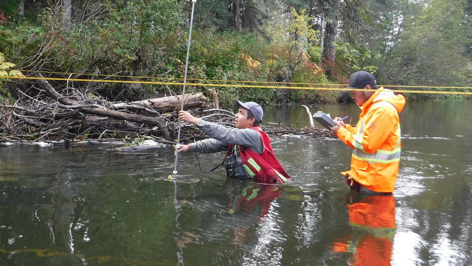
With very limited western science data available for water quality or quantity in the Gitanyow Lax’yip, the Gitanyow Fisheries Authority and the Gitanyow Lax’yip Guardians initiated a baseline water monitoring program. Building on the three hydrometric stations operated by the Water Survey of Canada, the Gitanyow added and operate seven stations, and have used the resulting data to develop preliminary environmental flow needs for three important watercourses in the Lax’yip – Hanna Creek, Tintina Creek and Cranberry River. Future plans include developing environmental flow needs for other high-priority systems, where there is significant risk to the water, or where proposed projects may have an impact on the watercourse.
For the three years of 2018-2020 staff collected year-round water quality data at sites representing five watersheds, contributing to the development of specific water quality parameters at these locations. The Gitanyow Fisheries Authority has also conducted limnology surveys for multiple years from May to October on several lakes, sampling nutrients and establishing physicochemical parameters with a view to developing water quality standards for these lakes.
Both Hanna and Tintina Creeks are important spawning creeks, but they have both been significantly degraded by logging. The dual impacts of historic logging impacts and climate change have meant that some years there is virtually no flow in some parts of the creeks. Now designated within a protected area called the Hanna-Tintina Conservancy that encompasses nearly the entirety of both watersheds, the purpose of the conservancy is to protect the high-value salmon spawning habitat that historically supported 80 per cent of Nass River sockeye.
Gitanyow staff are evaluating the value of recognizing other waterbodies, such as Strohn Creek, as important current and future spawning areas, given the impacts of climate change and relatively consistent flows in some of these waterbodies.
In 2016, Gitanyow began efforts to expand the Hanna Tintina Conservancy to include Strohn and Surprise Creeks, as well as the smaller streams that feed into Meziadin Lake. Despite five years of ongoing efforts from Gitanyow through the reconciliation table of the Joint Resources Governance Forum, however, the province has not taken any concrete action to protect the areas around Strohn and Surprise Creeks. A joint process to explore various provincial legal designations began in 2017, but to date no option has been selected by the province. Gitanyow is now seeking to establish the entire Meziadin area as an Indigenous Protected Area and communicate management direction to industrial proponents, specifically mineral exploration companies.
Glacier Surveys and Mapping
In support of developing the Gitanyow Water Policy, an inventory of glaciers in the Gitanyow Lax’yip was commissioned in 2019. Understanding the extent, size and rate of recession of glaciers in the Gitanyow Lax’yip is critical information to plan for and mitigate against climate change. As annual snowpack declines due to climate change, glaciers become even more critical in providing flows and cooling in summer months. Partnering with the Coast Mountain College in Terrace, the Gitanyow Lax’yip Glacier Inventory, 2020 provides the current state of glaciers in the Lax’yip, their rate of recession, and their meltwater contribution to various watersheds. Future work will include modelling for future further recession and potential implications for salmon ecosystems.
Water Policy
Most recently, Gitanyow Hereditary Chiefs staff have merged Gitanyow Ayookxw with the water quality and quantity data to create a draft Gitanyow Lax’yip Water Policy. The intent is to establish watershed-specific standards that anyone undertaking activities within the Lax’yip must adhere to. The policy establishes a classification of surface waters, procedures for evaluating water quality using water quality standards and assessment of biological communities, procedures for evaluating environmental flow needs, and a water management technical process. The policy was motivated by growing awareness among the Gitanyow around 2017 that water was becoming a scarce resource in many parts of B.C. and globally, and that future declines in water availability caused by climate change, compounded with the potential impact of upstream mining contaminants, could have significant impacts on salmon and salmon ecosystems.
Waterbody classification involves assigning Type I, Type II or Type III status to all waterbodies of the Lax’yip (see Figure 2). Type I waterbodies are the most sensitive or at highest risk due to ecological, hydrological and/or cultural significance or specific use. Type 1 waterbody characteristics include human consumption, high fishery or cultural value, are in protected areas and/or are highly vulnerable to climate change and its cumulative effects. In Type I waters, the natural flow regime must remain unaltered and water quality must meet or exceed current conditions. Type II waterbodies are at high risk or sensitivity and “provide critical upstream or downstream connectivity and processes that support human health, aquatic and terrestrial communities, and ecosystem function but may not currently directly support criteria/characteristics of Type I waterbodies”. Type II waterbodies provide important connectivity with Type I waterbodies, support other waterbodies or areas of ecological or cultural importance, and are vulnerable to climate change and cumulative effects. Flows in Type II waterbodies cannot be altered more than 10 percent and never below environmental flow needs. While additional human activities are permitted in Type II waterbodies, no alteration or degradation of instream conditions is allowed, and natural flow regimes must be maintained. Type III waterbodies are at lower risk or sensitivity. Water flows in Type III waterbodies may be altered up to 10 percent but never below environmental flow needs without “extensive additional field-based assessment to develop robust environmental flow needs and flow management planning”. Water quality in Type III waterbodies must meet or exceed water quality standards for the protection of aquatic, terrestrial and human health.

In addition to cultural, fishery and water supply values, there are also a number of climate-related criteria: thermal refugia, climate change risk and glacier conservation. Climate-related criteria emphasize the connection between decreasing snowpack, glacier mass, and summer-time droughts and the compounding risk this entails for already sensitive waterbodies. In many cases, climate change alone is all the impact that a sensitive waterbody may be able to tolerate, meaning that any water extraction or industrial use may be prohibited.
The policy also acknowledges the importance of restoration efforts, with one of the waterbody classification criteria being the need to develop and implement a recovery plan, and defines Gitanyow environmental flow needs:
Gitanyow “environmental flow needs” (EFN) are defined as the desirable conditions of streams on the Lax’yip that maintain natural in-stream flow regimes and sustain healthy ecosystems. This includes flows that allow for maintenance of flow-related watershed processes (e.g., flood plain maintenance).
The policy establishes water quality standards for specific sites based on the water quality data collected by Gitanyow Fisheries Authority and the Gitanyow Lax’yip Guardians. The standards represent annual maximum criteria that will require the development of site-specific, seasonally representative standards for specific project proposals.
Finally, Gitanyow recognize that climate change will make some waterbodies less suitable for fish and others more suitable. Therefore, they are working towards a high degree of protection for both types of waterbodies.
Conclusion
The integrated approach taken by the Gitanyow Hereditary Chiefs is creating a watershed governance approach based in the Gitanyow legal order expressed in a contemporary form to address 21st century water management challenges, including climate change.
Led by the Gitanyow Hereditary Chiefs, the Huwilp is creating a comprehensive understanding of the ecological health of our territory using both Indigenous knowledge and laws (Ayookxw) and western science, and translating that knowledge into policies that respond to the impacts of climate change.
This case study highlights the interconnectedness of climate change and water management, and the significant risks facing species of cultural significance that Indigenous peoples rely upon. Land use plans are foundational to addressing the cumulative effects of industrial development, providing spatial zones that highlight environmental values common to both Crown and Indigenous governments. However, climate change calls for greater conservation and management specificity around water management, in order to connect land and water planning in an integrated and holistic manner.
Recommendations
For Indigenous governing organizations:
- Develop or adapt watershed/land use plans based on your Indigenous legal orders that specifically assess climate change impacts and risks, including environmental flow needs;
- Consider how governance instruments like policies or governance processes can address constraints and opportunities related to climate change;
- Declare your environmental flow needs publicly as a statement of your Indigenous laws;
- Require state governments and proponents to provide details on how proposed projects will exacerbate climate change impacts and how they will mitigate those impacts.
For Indigenous and settler watershed managers:
- Gather Indigenous knowledge on ecological baselines in your territory, in particular water quality and flow;
- Continue to formally document the existing climate change impacts your community is experiencing. Consider reporting to leadership these impacts in an annual report or state of the territory report;
- Establish ecological monitoring programs that include both Indigenous knowledge and western science methodologies;
- Monitor the impacts of existing activities in the territory and evaluate proposed activities using a climate change screen.
- Consider how future projected climate change will impact water and ecological resources, and plan for these in management strategies.
For Crown governments:
- Incorporate climate change screens and assessment criteria into all land use and water management planning and approvals processes;
- Revise land use and water management parameters, such as orders under forestry legislation, to account for territory-specific anticipated climate change impacts;
- Enter into consent-based agreements with all First Nations or Indigenous governing organizations for all planning and approvals processes that enable adaptive assessment, monitoring and evaluation processes for cumulative impacts—including from climate change— throughout a territory;
- Fund community-led data gathering, monitoring and assessment using both Indigenous and western scientific knowledge;
- Create an interactive and public data management platform that will house non-confidential data on which all parties can rely.
About the authors
Tara Marsden holds the name Naxginkw and is a member of the Gitanyow Huwilp and acted as Wilp Sustainability Director for the Gitanyow Hereditary Chiefs for nine years. Deborah Curran is a lawyer with the Environmental Law Centre and professor at the University of Victoria and co-writes in allyship, therefore the article is written in first-person.
References
The Constitution Act, 1982, being Schedule B to the Canada Act 1982 (UK), 1982, c 11.
Gitanyow Fisheries Authority (Kevin Koch and Jeffrey Anderson). 2018. Hanna, Tintina and Strohn Creeks Habitat Assessment and Restoration Initiative Year 4.
Gitanyow Nation and Province of British Columbia. 2016. Gitanyow Huwilp Recognition and Reconciliation Agreement.
Gitanyow Hereditary Chiefs. 2021. Gitanyow Lax’yip Water Policy (Draft).
Gitanyow Hereditary Chiefs. 2009. Gitanyow Constitution.
Gitanyow Hereditary Chiefs. Legal Principles Underlying the Gitanyow Lax’yip Land Use Plan.
Gitanyow Huwilp Society. 2018. Gitanyow Lax’yip Water Quantity and Quality Plan: Scoping Document and Proposed Framework Phase 1 Scoping Document.
Matthew J. Beedle, PhD and Monica Jeffrey. 2020. Meziadin Lake Watershed and Gitanyow Lax’yip Inventory.
Ministry of Environment and Climate Change Strategy. Preliminary Strategic Climate Risk Assessment for British Columbia 2019.